
GPS devices can be useful but they can rarely replace a good (waterproof) map and map readings skills when you are out on the hills.
A guest article by Mike Thompson of Aqua3.
Most walkers are big fans of printed maps, and looking to them before going out on a walk is half of the fun! But more and more often, you hear the question, “Why would anyone carry a printed map when they can get all the information they need on their smart phone or GPS device?”
Well, that’s actually a valid question. Electronic devices use the latest data, are fairly accurate provided they can “see” the satellites, and can tell you both where you are and what route to take (provided you stick to paths and roads). You can zoom in and out to find the detail you need. They don’t take up much space and are convenient to handle.
On the other hand, a printed map sheet doesn’t require batteries and will survive being dropped. (Our waterproof maps will even stay readable in the rain and survive muddy puddles.) You can read a printed map in bright sunlight and by the light of a torch. It shows a wide area so you can orient yourself and identify landmarks for when you decide to strike off from the beaten track.

Map with mud… no problem!
Today’s map data and printing technology also means that you can order a custom-printed “site centred” map. By choosing the centre point for your map and the scale you want, you can create a map that covers exactly the area you need, with the level of detail best suited to your journey. At Aqua3, our printers allow us to print maps that have extra width or height, so you can cover your route with fewer sheets.
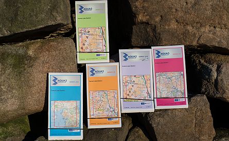
Waterproof maps produced by Aqua3
There’s also something special about unfolding a paper map and pouring over it, either as you plan your walk or to revisit it afterwards. When you can view a large area, you can spot unusual features and undiscovered landmarks. Your map becomes a visual memory aid – helping you to stay on course and to remember where you’ve been.
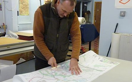
A waterproof map in production
So, in fairness, we’d say that it comes down to personal preference, but we think the printed map will be around for a long while yet. And we’d also add that, whether you use an electronic device or printed maps or both, it’s still important to make sure you have the basic map reading and navigational skills to use them properly.
About Mike Thompson
![]() Mike Thompson is the owner of Aqua3, a company that specialises in creating customised waterproof maps using OS mapping data. He wanted to find the solution to an age-old problem – how to improve the durability of maps, particular in bad weather conditions - and he has succeeded. Through his patented process patented process he produces highly durable, water-proof maps that can still be folded. Maps start from £ 12.99. Visit his website www.aqua3.com for more information and to buy a splash proof map.
Mike Thompson is the owner of Aqua3, a company that specialises in creating customised waterproof maps using OS mapping data. He wanted to find the solution to an age-old problem – how to improve the durability of maps, particular in bad weather conditions - and he has succeeded. Through his patented process patented process he produces highly durable, water-proof maps that can still be folded. Maps start from £ 12.99. Visit his website www.aqua3.com for more information and to buy a splash proof map.